ATTENTION : SHIPPING ALL OVER EUROPE !
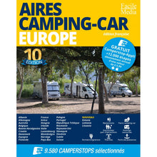
Aires Camping-Car Europe 10ème édition, guide rédigé en français.
Aires Camping-Car Europe ist die französische Version von Camperstop Europe.
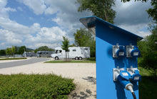
This guide provides an excellent overview of the airs or stages in almost all of Europe. Symbology, photos and GPS coordinates make it easy to understand the contents of the guide. The airs are for the exclusive use of camping-cars and campers. These airs can be made viable (water, glass, some even have electricity), stationed and naps are possible, often free of charge. Some airs can be located in idyllic locations, in picturesque villages or on the banks of large towns.
Aires Camping-Car Europe 10th edition.
-AiresCamping-Car 10ème édition Europe is published in A4 format. 9580 airs in 30 countries ofEurope,includingScandinavia: Denmark, Sweden, Finland and Norway,but also: Romania, Slovakia, Poland, Czech Republic, Bosnia-Herzegovina and Albania.
30 countries in total !!!France, Germany, Netherlands, Greece, Greece, Italy, Albania, Norway, Austria, Belgium, Bosnia-Herzegovina, Croatia, Denmark, Slovakia, Slovenia, Spain, Estonia, Finland, Hungary, Ireland, Latvia, Lithuania, Luxembourg, Montenegro, Poland, Portugal, United Kingdom, Czech Republic, Romania, Sweden, Switzerland.
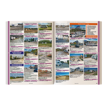
Main features : +Redited in French +743 pages in A4 format +9580 zones in 30 countries +7751 photos of zones +GPS coordinates of each zone.
Comment utiliser Aires Camping-Car Europe 10ème édition.
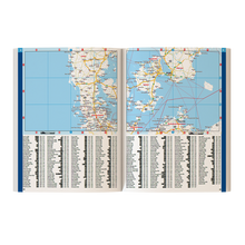
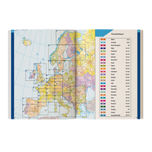
The Aires Camping-Car Europe maps have been updated for this 10th edition. The location of the 42 cards is always at the beginning of the guide. In the guide, the stops/stops are identified by a red dot next to the name of the nearest town. The zones can be searched in the alphabetical index or in the regional sections of each country.
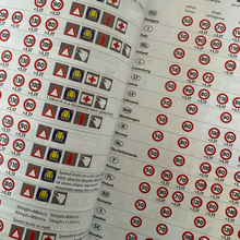
The list of regions can be found in the index adjacent to the map or in the alphabetical index at the end of the book. Both indexes include symbols next to the city name to indicate what type of region it is. Information is provided for each country concerning driving rules, signaling panels, emergency numbers, type of currency and certain parking rules.
Format The format of the guide indicates the name of the street and the GPS coordinates in decimal format: N31.36297 W5.01915.
Short indications are then given, such as: "Le parking de la Marina or Parking next to the bus parking". Following are the opening hours, available spaces, prices and services available, the latter being identified by symbols.
Additional information Many stages of the guide also provide information on tourist attractions, such as museums, markets, monuments, etc. At the same time, general comments on the city or the situation of the region can be found: "modern port city", "seaside resort with casino" or "ski slopes".
The guide explains that: "In some countries, there is a concept oftolerated camping airs, which means that camping/night camping is officially forbidden, but that the local authorities tolerate them for one reason or another.
As long as you keep your camping equipment (tables, chairs, barbecues, etc.) inside your camping-car and that you do not park in an area where there is an infraction or a law, you do not risk to be left behind. Problems arise when many camping-cars use or choose these "unofficial" sites at the same time and/or in an irrational way.


